Category Archives: Trips

Trips by MinnesotaSeasons.com

First Wildflowers at Hastings Sand Coulee SNA

Hastings_Sand_Coulee_SNA_04
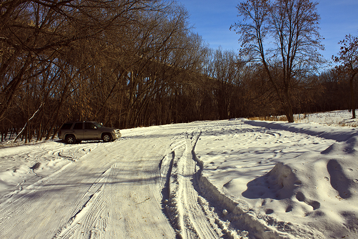
It was warm(ish) and mostly sunny when I arrived at the North Unit of Hastings Sand Coulee SNA on Saturday. Directions on the Minnesota DNR Web page for this site say “Park at the stormwater utility”. I parked at the curb across the street, not wanting to block the narrow utility road.

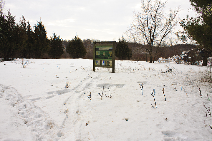
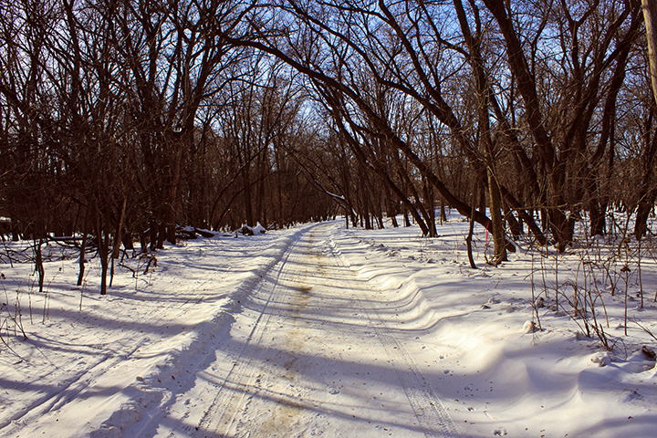
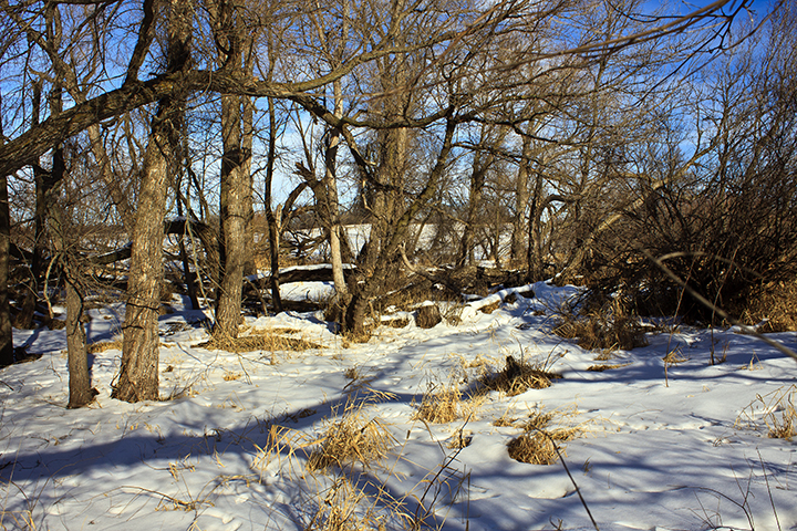
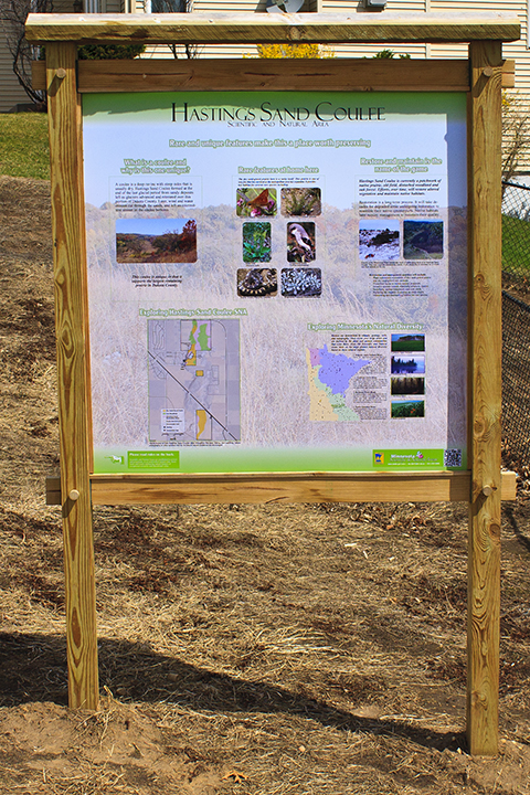
There is a padlocked gate across the utility road. The gate, the padlock and chain, and the nearby interpretive sign all look new. This unit of Hastings Sand Coulee SNA was acquired in 2011, 80 acres from a private owner, 25 acres from the City of Hastings, and a transfer of 80 acres from adjacent Hastings WMA.

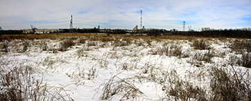
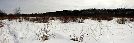
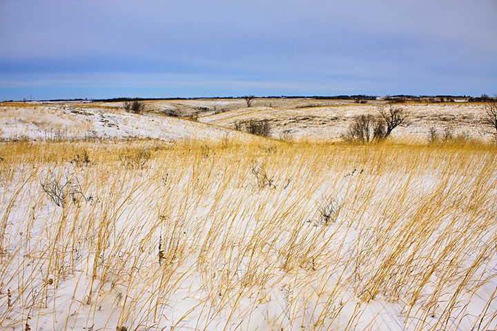
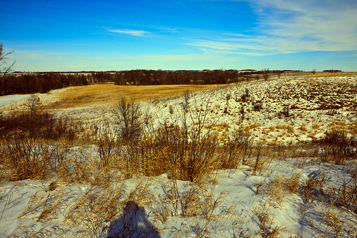
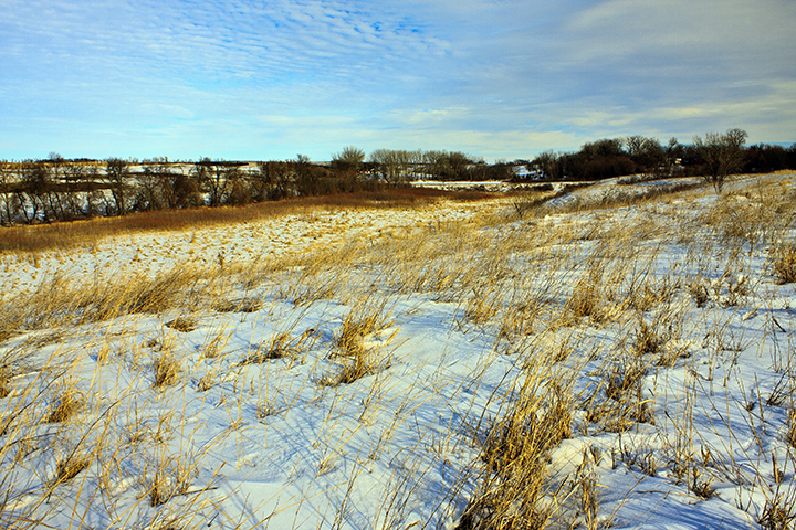
The Friends of the Mississippi River (FMR) has done considerable work restoring this site. This is especially apparent on the eastern slope, the area designated Dry Sand – Gravel Prairie (Southern) (see page 4, native plant communities (NPCs), of the North and Center Units map at MinnesotaSeasons.com). Following decades of fire suppression, what had once been a hill prairie has become bur oak woodland. Most of the shrub layer in this section has been removed recently, leaving many small stumps and several large circles of ash.

Hastings_Sand_Coulee_SNA_09

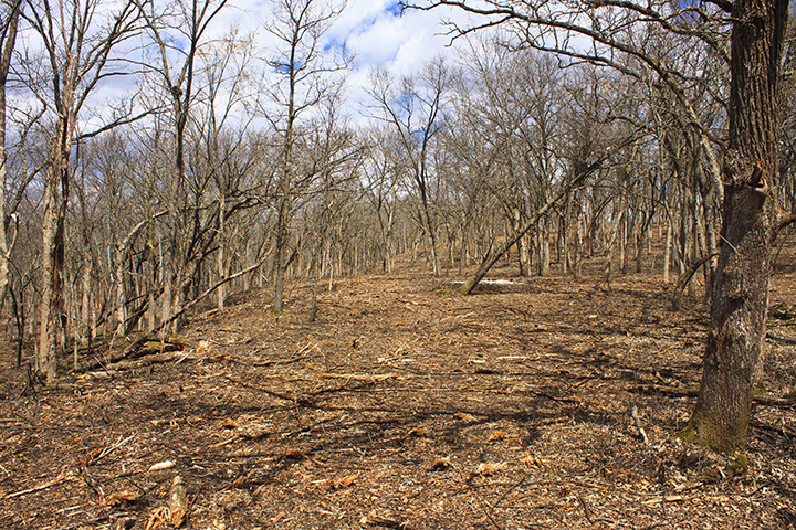
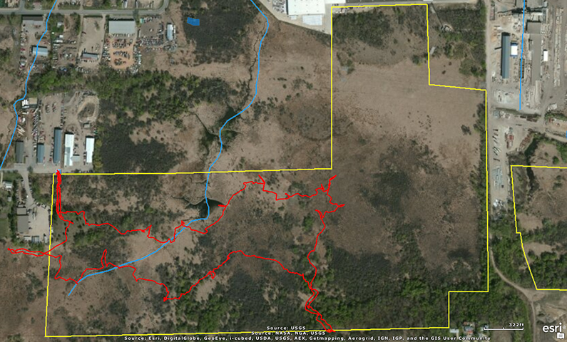
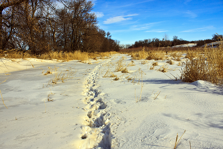
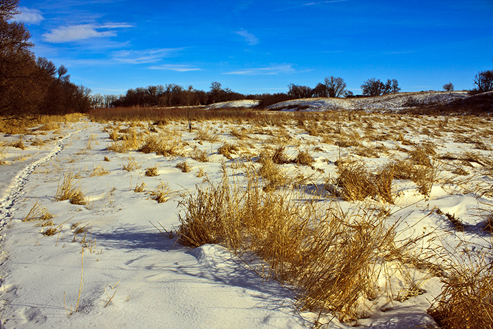
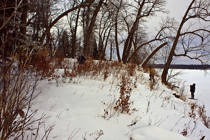
I hiked the perimeter of the south section then followed the eastern slope to the northern boundary. There is a gated entrance on Nicolai Avenue (County Road 91) but no place to park. On the northern boundary there is a metal folding chair in front of a tree overlooking the long valley below. The chair is slightly rusted. It looks like it has spent only one winter here. This is a good spot to stop for a while to look and listen for birds.

Dutchmans_breeches_07

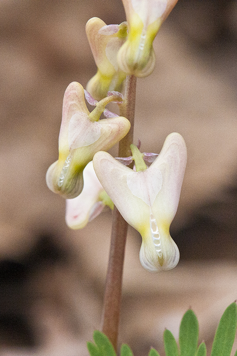
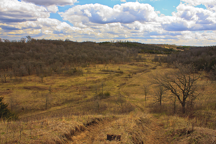
Continuing west, I started up the east-facing slope, the area labeled Dry Barrens Prairie (Southern) on the NPC map. It was here that I saw the first blooming wildflowers of this trip and of this season. It was a scattering of Dutchman’s breeches (Dicentra cucullaria) with small, greenish-white, immature flowers. Ascending the slope the flowers became progressively larger. Those at the top of the slope were white and fully formed. West of the coulee is a bare field. It appears to have been recently burned, probably in the fall since no charred vegetation is visible. Heading south I flushed an American Woodcock and saw the first dragonfly of the season, a common green darner.

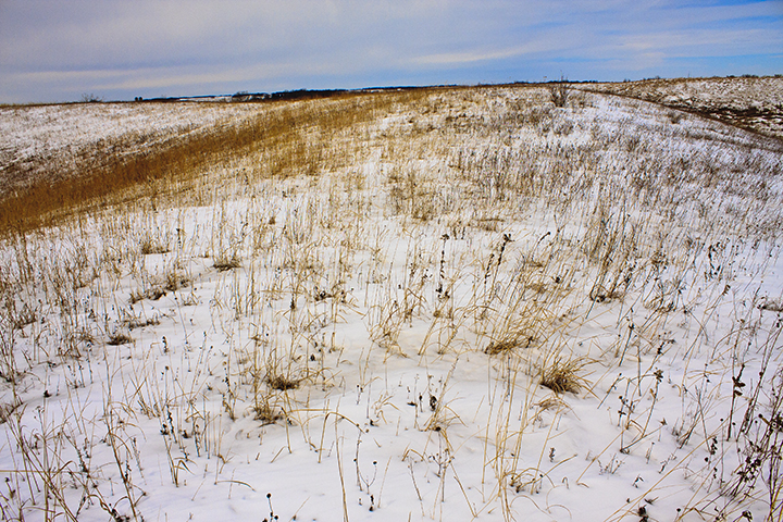
A sandy draw about 230 yards south of the north boundary leads to the valley below. Half way down this draw there is a large patch of Carolina thimbleweed (Anemone caroliniana), also called Carolina anemone. All of the flowers were white and most were at least partially open. Pennsylvania sedge (Carex pensylvanica), also blooming, was mixed with the Carolina thimbleweed.

Hastings_Sand_Coulee_SNA_11

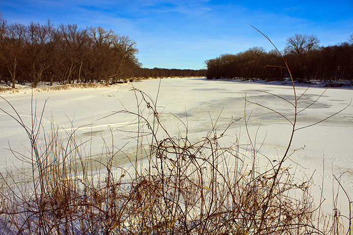
There is a small cemetery overlooking the coulee. A sandy draw near the south end of the cemetery leads into the coulee in the south section. The slope east of the draw is covered with western androsace (Androsace occidentalis), also called western rock-jasmine. White flowers on many of the plants were visible but not open. The draw leads to a drainage pond on what was formerly City of Hastings property. The pond is completely dry.

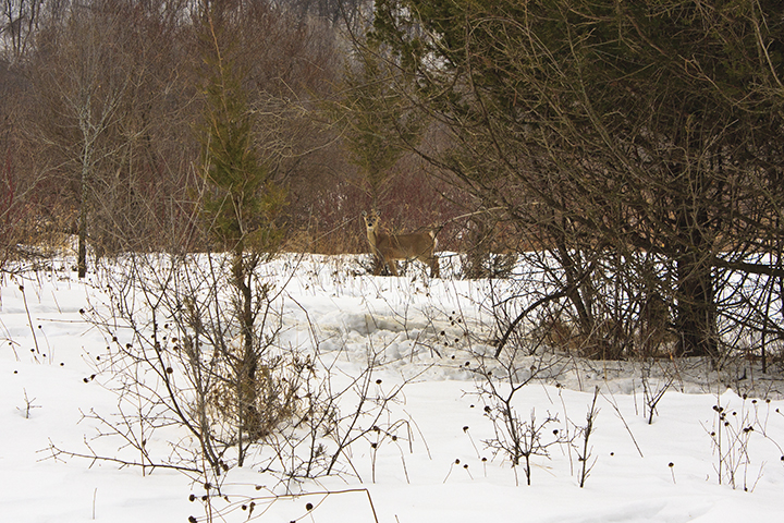
Other birds spotted on this trip, along with the American Woodcock, include a Broad-winged Hawk, a Red-tailed Hawk, a Wild Turkey, an Eastern Bluebird, and thirteen other bird species.

Savage Fen Trip Report March 9, 2014

Savage_Fen_SNA_08The first warm(ish) weather of 2014 called to me and I answered the call. I threw the snowshoes in the back of the Trailblazer and headed to the newly expanded West Unit of Savage Fen SNA.

I parked near the wood SNA sign, put on the snowshoes, and walked the 130 yards to the information kiosk. Just then the sun came out from behind a thin but dense layer of clouds. I realized I did not bring my sunglasses so I went back to the Trailblazer and got them. By the time I got back to photograph the kiosk area the sun was once again hidden behind the clouds. That was the only sun I was to see all day.Savage_Fen_SNA_10

Savage_Fen_SNA_11 The kiosk area has a few well developed eastern redcedar trees. Packed snow and droppings beneath the trees indicate that this area is popular with whitetail deer. As I scanned the area I caught sight of movement near the south edge of the clearing. A deer approached the open area unaware of my presence. I managed to get the camera out without alerting the deer and took a couple of photos. Unfortunately, the only lens I brought was an 18-55mm wide angle zoom lens. This lens is good for landscapes but not for bringing distant objects closer. After a minute the deer saw me and bounded away.

There were several deer trails to choose from leaving the kiosk area. I chose one leading south and then west. Before long I realized that the trail took me off of the SNA and I doubled back. I headed east following many deer trails showing little to moderate – but some – usage. Hard packed snow beneath the more recently fallen snow helps to support the weight of a person on snowshoes. It reduces by close to 50% (my unscientific estimate) the effort required for each and every step.Savage_Fen_SNA_12

In the almost circular calcareous fen near the middle of the SNA I came across something I had never seen before. On the left (north) side of the deer trail the snow was 16″ deep and loose. On the right (south) side of the trail was an irregular shelf of yellowish ice rising 6″ to 8″ above the snow with little snow covering it. I tested the ice with my pole and it was thick and solid. A little farther on I came across another ice shelf, this one 8″ to 12″ above the snow with no snow covering it. A small area, no more than the size of a peanut butter jar lid, had visibly flowing water on top of the ice – a spring! The slow but continuous flow of water explains the irregular surface of the ice shelf.

Calcareous Fen

Calcareous Fen

If a person falls in a ravine while wearing snowshoes and finds their legs and head in the air and their rump in the ravine, they will need to come up with a strategy to get themselves back on their feet. I’m just saying.

Seepage Meadow/Carr

Seepage Meadow/Carr

Along with the one whitetail deer I saw several American Crows, two Wild Turkeys, and a hawk I was unable to identify. I heard Northern Cardinals, Black-capped Chickadees, Blue Jays, a Northern/Yellow-shafted Flicker (don’t get me started), and a Mourning Dove.

Deer's-eye view of a buckthorn thicket

Deer’s-eye view of a buckthorn thicket

Total snowshoeing was 2.7 miles and 3 hours and 45 minutes. The high temperature in Savage today was 46°. By the end of the trek the snow on top was the consistency of wet sugar – heavy but still granular.Savage_Fen_Trip_Report_March_9_2014

Snowshoeing in February

It was 38° and partly sunny when I arrived at Des Moines River SNA at noon on Tuesday. The warm front the day before brought three inches of fresh snow. Mine were the first tire tracks in the parking area at Christianna Bridge Public Water Access.

Des_Moines_River_SNA_50

I strapped on the snowshoes and headed up the hill to the southwest corner of the SNA. A Red-bellied Woodpecker complained until I was out of site, repeating its rolling, one-second long churr every few seconds. At the SNA boundary marker there were fresh Red Fox tracks on top of yesterday’s snow. A single line of tracks meandered east, following the fence line that forms the SNA boundary. At one point there was a jumble of many tracks around a small, jagged, mostly filled in hole. The fox apparently dug for and possibly found a vole or mouse.

Des_Moines_River_SNA_51

I continued east following the SNA boundary. With each step my snowshoes sank twelve to eighteen inches into the snow. I had to lift my knees high with each step to avoid dragging the toe of the snowshoe through the snow at the lead edge of the shoe print. At this rate I knew that if I would be worn out soon unless something changed. I began searching for sign of a deer path.

Deer path

Deer path

There were no fresh tracks in sight, but I soon found a path buried under the snow. It appeared as a somewhat straight line where a little less grass protruded from the snow. I stepped onto the path and the snow held my weight.

Snowshoe prints on deep path

Snowshoe prints on deer path

For the next two hours I explored the south half of the SNA. I walked on deer paths where they were available but they seldom went where I did. Other sightings this day include four whitetail deer, several Black-capped Chickadees, about thirty LBJs (Little Brown Jobs—unidentified sparrows), and the tracks of a Ring-necked Pheasant.

Deer highway

Deer highway

Fort Snelling State Park

Today is the first day in four and the last day in ten with a daytime high temperature in the Twin Cities above 20°F. On January 25 the daytime high temperature was 24°F. According to the Web site Weather.com it will snow tomorrow then get cold and stay cold for the next ten days. Beyond that Weather.com does not have a prediction. If I want to get outdoors, today is the day. I do, and I did.

A thin layer of cirrus clouds filtered the sun when I arrived at Fort Snelling State Park a little after noon. I went into the park office to get a map and talk to the park ranger on duty. The woman behind the counter said that the trails were groomed and snowshoes were not necessary. She also said that on Pike Island the inner trails were open but the outer trails, those nearest the Minnesota River, were closed. The best place to photograph the river would be Picnic Island. That is where I headed next.

Fort_Snelling_State_Park_01

I parked in the northernmost lot on Picnic Island, turned on my Garmin GPS, and headed north to the New Hope Trail. No, I was not afraid of getting lost in this small suburban oasis. I keep a GPX track of every hike.

Fort_Snelling_State_Park_02

The trails are well packed with just two to three inches of loose snow on top. I left the trail and approached the picnic shelter near the west end of the island. Two Wild Turkeys emerged from the woods about 100 yards to the west. I stopped and watched as a long line of ten turkeys slowly walked from the woods to the frozen river. The lead turkey had a waddle that swung from its neck almost to the ground. Less than a minute after the last turkey cleared the woods three whitetail deer emerged at the same spot. They looked around then took the same path as the turkeys to the river. They were followed closely by a group of six more deer. When the last of the deer was out of site I started back to the trail, not wanting to spook the wildlife.

Fort_Snelling_State_Park_03

I needn’t have worried about spooking the deer. Fifteen minutes leaving the picnic shelter area I passed another small group of whitetail deer in the woods not more than 20 feet northeast of the trail. Three were standing and watching me closely, two were lying down and ignoring me. Not wanting to spook them I did not slow my pace and I looked at them mostly with my peripheral vision.

Fort_Snelling_State_Park_08

After my hike on my way out of the park, just west of the park office, I saw another large group of Wild Turkeys. There were at least 25 turkeys in the woods just north of the park drive.

Fort_Snelling_State_Park_11

There is a lot of wildlife in close proximity to a lot of human visitors in this small suburban park

Snowshoeing at Des Moines River SNA

The warm spell between the polar vortex and its little brother provided an opportunity for another visit to Des Moines River SNA. For the first time in 16 months the snow here is deep enough and firm enough to snowshoe.

Christianna Bridge Public Water Access, the unofficial parking area for this site, is a popular destination year round, especially on weekends. When I pulled into the snow-covered parking lot there was a Pickup with a very long snowmobile trailer already there. While I strapped on snowshoe    s I was greeted (scolded?) by the screech of a Red-tailed Hawk. This may be the same hawk, the only hawk, that I see every time I visit Des Moines River SNA. As I headed up the bluff to the SNA four more pickup trucks, two towing ATVs and snowmobiles, pulled into the parking lot. I turned north.

Des_Moines_River_SNA_43

A small herd of 11 whitetail deer were in the wooded area adjacent to the intermittent stream just north of the parking area. When they saw me they ran, apparently heading for the larger woods to the north.

Snow is firmly packed over well-travelled deer trails. On this day it was often firm enough to support my weight. Where practical I followed deer trails. Many of the trails were fresh. Others were completely buried by the recent snow and appeared as narrow strips with slightly less grass protruding from the snow.

Des_Moines_River_SNA_45

I avoided most of the wooded area and turned west when I reached northern boundary. A fire break was cut through the willows along the north boundary making travel through this section much easier. As I followed the fire break Ring-necked Pheasants were flushed in groups of mostly 2 or 3. Between the woods on the west and County Road 79 at the eastern boundary I (inadvertently) flushed at least 25 pheasants, possibly as many as 40. I was careful not to double count any birds.

Des_Moines_River_SNA_47

Des_Moines_River_SNA_46

I turned south at the “mother of all deer blinds”, a large, four-walled platform atop a 25′ high, 18″ in diameter pole. I followed the east boundary until I got to “Mirabilis Way”, a narrow strip of land leading ¼ mile to the SNA’s official parking spot on the shoulder of County Road 79. I gave the corridor that name because it is densely choked for almost its entire length with white sweet clover and yellow sweet clover. I turned east here following an old roadbed as far as it went. I crossed the intermittent stream, turned southwest, and headed back to the parking area.

Des_Moines_River_SNA_48

This was a short trip, 3¼ hours but only 3.3 miles.

Potluck

The Minnesota DNR hosted the annual Potluck for the Scientific and Natural Area site stewards at Itasca State Park. Though scheduled well in advance they could not have chosen a better weather day. Following the frigid subzero temperatures of the polar vortex this was the first day of the new year that saw daytime temperatures climb above 20°F. Attendance seemed to be up over 2013 despite roads that were slick in some areas. It was fun meeting other site stewards and sharing impressions of their SNAs.

Itasca_State_Park_06

After two hours of socializing we broke into groups and headed out to visit SNAs. Two groups went to the La Salle Lake SNA. One group went to the densely wooded section east of the Mississippi River. The second group went to the bluff south of the river where there is a spectacular overlook with a view of the Mississippi River valley. The third group included Peggy Booth, DNR Scientific & Natural Areas Program supervisor, and was led by Kelly Randall, DNR SNA outreach coordinator. Kelly and Peggy were on skis, the rest of us on snowshoes. We skied/snowshoed to the Itasca Wilderness Sanctuary SNA.

Itasca_Wilderness_Sanctuary_SNA_02