 It was warm(ish) and mostly sunny when I arrived at the North Unit of Hastings Sand Coulee SNA on Saturday. Directions on the Minnesota DNR Web page for this site say “Park at the stormwater utility”. I parked at the curb across the street, not wanting to block the narrow utility road.
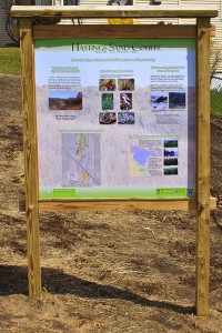
There is a padlocked gate across the utility road. The gate, the padlock and chain, and the nearby interpretive sign all look new. This unit of Hastings Sand Coulee SNA was acquired in 2011, 80 acres from a private owner, 25 acres from the City of Hastings, and a transfer of 80 acres from adjacent Hastings WMA.
The Friends of the Mississippi River (FMR) has done considerable work restoring this site. This is especially apparent on the eastern slope, the area designated Dry Sand – Gravel Prairie (Southern) (see page 4, native plant communities (NPCs), of the North and Center Units map at MinnesotaSeasons.com). Following decades of fire suppression, what had once been a hill prairie has become bur oak woodland. Most of the shrub layer in this section has been removed recently, leaving many small stumps and several large circles of ash.
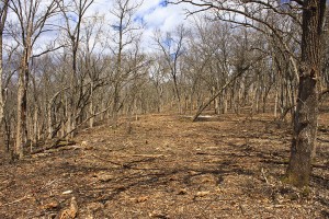
I hiked the perimeter of the south section then followed the eastern slope to the northern boundary. There is a gated entrance on Nicolai Avenue (County Road 91) but no place to park. On the northern boundary there is a metal folding chair in front of a tree overlooking the long valley below. The chair is slightly rusted. It looks like it has spent only one winter here. This is a good spot to stop for a while to look and listen for birds.
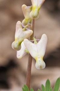
Continuing west, I started up the east-facing slope, the area labeled Dry Barrens Prairie (Southern) on the NPC map. It was here that I saw the first blooming wildflowers of this trip and of this season. It was a scattering of Dutchman’s breeches (Dicentra cucullaria) with small, greenish-white, immature flowers. Ascending the slope the flowers became progressively larger. Those at the top of the slope were white and fully formed. West of the coulee is a bare field. It appears to have been recently burned, probably in the fall since no charred vegetation is visible. Heading south I flushed an American Woodcock and saw the first dragonfly of the season, a common green darner.
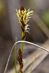
A sandy draw about 230 yards south of the north boundary leads to the valley below. Half way down this draw there is a large patch of Carolina thimbleweed (Anemone caroliniana), also called Carolina anemone. All of the flowers were white and most were at least partially open. Pennsylvania sedge (Carex pensylvanica), also blooming, was mixed with the Carolina thimbleweed.
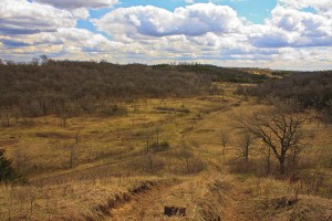
There is a small cemetery overlooking the coulee. A sandy draw near the south end of the cemetery leads into the coulee in the south section. The slope east of the draw is covered with western androsace (Androsace occidentalis), also called western rock-jasmine. White flowers on many of the plants were visible but not open. The draw leads to a drainage pond on what was formerly City of Hastings property. The pond is completely dry.
Other birds spotted on this trip, along with the American Woodcock, include a Broad-winged Hawk, a Red-tailed Hawk, a Wild Turkey, an Eastern Bluebird, and thirteen other bird species.

