Category Archives: Nature Destinations

Carpenter St. Croix Valley Nature Center

Carpenter St. Croix Valley Nature Center

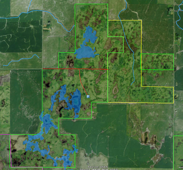
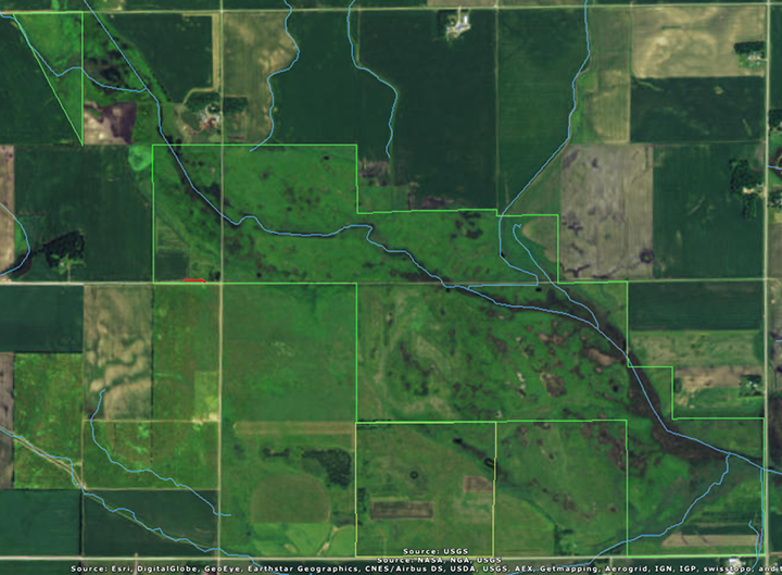
Carpenter St. Croix Valley Nature Center is a 725-acre private preserve spanning both sides of the St. Croix River. It is free and open to the public. The 425-acre Minnesota “Campus” is in Washington County just northeast of Hastings. The Visitor Center has a number of live animals on display, including a Bald Eagle and a Peregrine Falcon. A number of non-native trees and shrubs around the Visitor Center and parking area will challenge the identification skills of any visiting plant enthusiast.

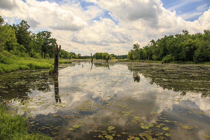
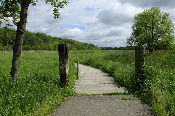
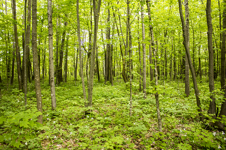
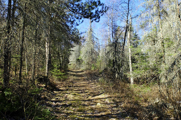
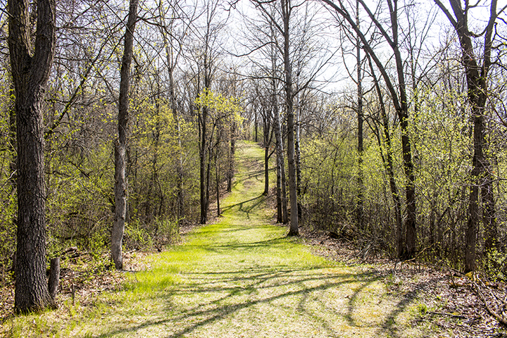
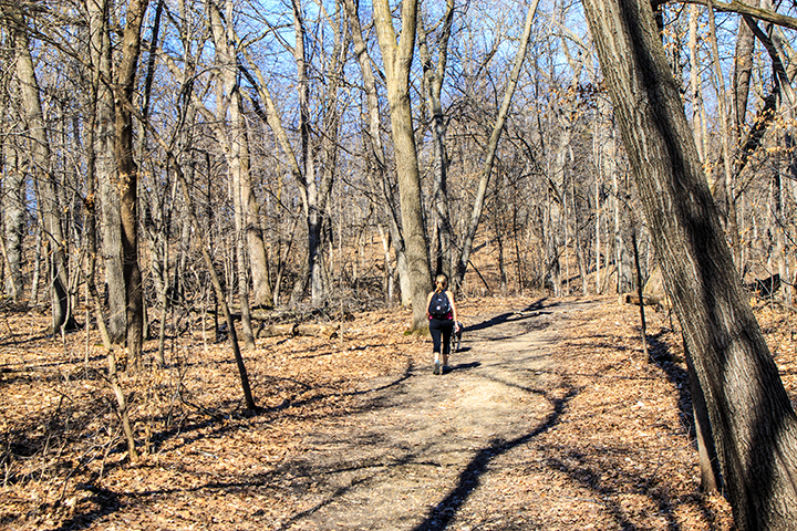
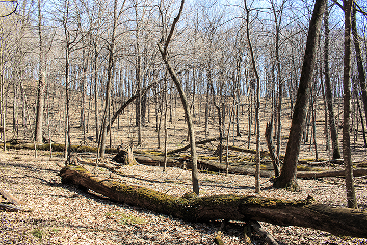
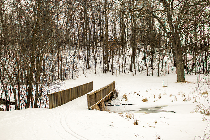
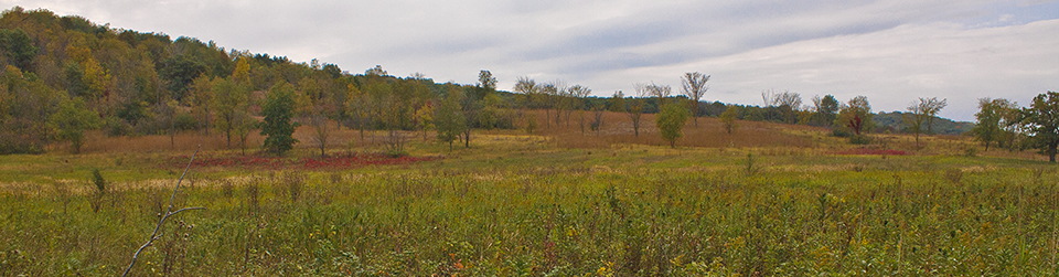
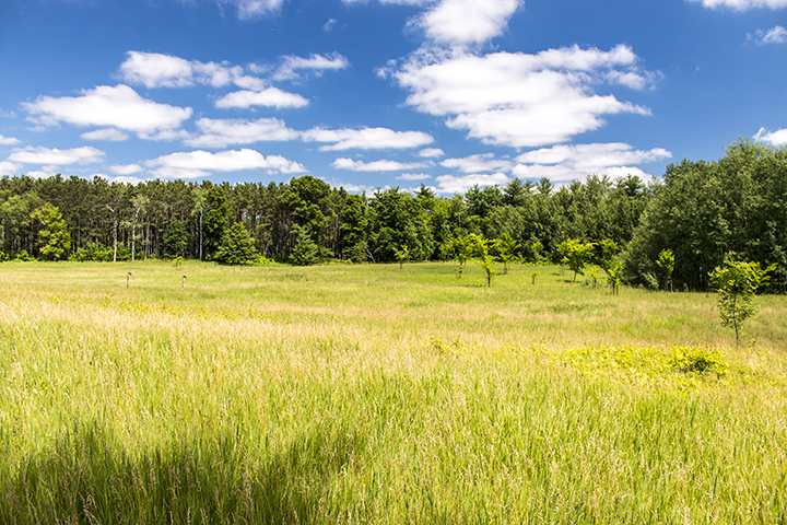
The Minnesota Campus includes areas of grassland, oak savanna, red pine plantation, deciduous forest, and wetland. It also includes three native plant communities. On the east side of St. Croix Trail (County Hwy. 21) there are 5.6 miles of trail, 3.5 miles of them paved, leading across river bluffs, into deep forested ravines, and through floodplain forest bordering the St. Croix River. On the west side of the road about 4 miles of mowed trail wind through a 150-acre restored prairie.

http://minnesotaseasons.com/Destinations/Carpenter_Nature_Center.html

Kasota Prairie

Kasota Prairie

Kasota Prairie, not to be confused with nearby Kasota Prairie Scientific and Natural Area, is a 90-acre private preserve in Le Sueur County. It is owned and managed by Unimin Corporation in cooperation with Save the Kasota Prairie, a non-profit, tax-exempt organization. It is open to the public.

Kasota Prairie contains virgin prairie, previously grazed and restored prairie, forested river bluffs, and shoreline of the Minnesota River. It includes three small pockets of one native plant community, Dry Sand – Gravel Prairie (Southern).

Birders can see Eastern Meadowlark and Dickcissel on the prairie, Baltimore Oriole and Great Crested Flycatcher on the bluffs, Belted Kingfisher and Great Blue Heron on the river, and Red-tailed Hawk and Turkey Vulture soaring overhead. Hikers this week (6/5 to 6/11/2016) will find hoary puccoon, Canada Anemone, golden alexanders, and a few prairie violets in bloom.

http://minnesotaseasons.com/Destinations/Kasota_Prairie.html

Crosby Farm Regional Park

Crosby Farm Regional Park

Photo by Kirk Nelson

At 583 acres Crosby Farm Regional Park is the largest park in the City of St. Paul park system. It sits north of the confluence of the Mississippi and Minnesota Rivers. It is near the northern end of a 22 mile continuous track of protected river corridor stretching from Cherokee Regional Park in St. Paul to Valleyfair in Shakopee.

Crosby Farm Regional Park provides 6.7 miles of hiking trails through river bottomland. It contains oak forested bluffs, floodplain forest, various wetlands, and two lakes. Four native plant communities are found within its borders. It is frequently flooded in the spring.

http://minnesotaseasons.com/Destinations/Crosby_Farm_Regional_Park.html

Mille Lacs WMA

Mille Lacs WMA

Mille Lacs Wildlife Management Area protects 60.5 square miles of moist hardwood forest and wetlands in east-central Minnesota. About sixty percent of the WMA is forested, mostly moist red oak – basswood forest. The remainder is wetland, mostly sedge meadow and willow – dogwood shrub swamp. There are 80 parking areas and about 100 miles of forest roads, hiking trails, and hunter walking trails within the WMA.

Hunters can stalk deer, bear, small game, forest birds, and waterfowl. Fur-bearer trapping is allowed with a permit. Non-game wildlife found here include red-shouldered hawk and four-toed salamander, both species of special concern in Minnesota. Protected plants found here include bog bluegrass, little goblin moonwort, narrow triangle moonwort, and least moonwort.

Visitors to Mille Lacs WMA on Memorial Day weekend will see large-flowered trillium peaking and will attract large numbers of mosquitoes. DEET is highly recommended.

http://minnesotaseasons.com/Destinations/Mille_Lacs_WMA.html

Laurentian Divide Recreation Area

Laurentian Divide Recreation Area

Photo by Kirk Nelson

The Laurentian divide is the continental divide separating the area where water flows north to the Hudson Bay or the Arctic Ocean from the area where water flows south to the Atlantic Ocean, Caribbean Sea, or Gulf of Mexico. It stretches from northern Newfoundland south and then west to the Great Divide at Triple Divide Peak in Glacier National Park in Montana. In Minnesota it stretches from the Boundary Waters Canoe Area Wilderness in Cook County to Browns Valley in Traverse County.

The Laurentian Divide Recreation Area, in the Superior National Forest near Virginia, Minnesota, has 15 miles of hiking and skiing trails and 5 miles of mountain bike trails.

http://minnesotaseasons.com/Destinations/Laurentian_Divide_Recreation_Area.html

Wambach WMA

Wambach WMA

Wambach Wildlife Management Area (WMA) is a 1,288-acre reserve in northwestern Minnesota. It consists of two units separated by Santee Prairie SNA. The large 1,209-acre West Unit is a mosaic of mesic prairie, shallow lakes, ponds, large areas of cattail marsh, and various wetlands. The 79-acre East Unit is mostly mesic prairie with some wet prairie and wetlands.

Deer, small game, forest game birds, pheasants, and waterfowl can be hunted here. Small white lady’s slipper (Cypripedium candidum), a species of special concern, is found here. A survey in 1994 found 12 Powesheik skipperling (Oarisma powesheik), a federally endangered butterfly, on this site. This small butterfly has not been seen in the last 10 years in Minnesota.

http://minnesotaseasons.com/Destinations/Wambach_WMA.html

Woodland Trails Park

Woodland Trails Park

The City of Elk River describes Woodland Trails Park as “crown jewel of the Elk River Park system”. That may make it sound like a big fish in a little pond, but that phrase would not do it justice. This 371-acre park has two native plant communities, about 10 miles of hiking trails, and a biathlon range. The trails are wide and well marked, including distance markers every kilometer.

Woodland Trails Park preserves an area of low hills and swales formed by the advance of the Wisconsin glaciation about 12,000 years ago. Today, the area is mostly covered in a oak-maple woodland. A small black ash swamp occupies a low area to the west.

Visitors this weekend (4/24/2016) will find rue anemone peaking throughout the park.

http://minnesotaseasons.com/Destinations/Woodland_Trails_Park.html

Expandere WMA

Expandere WMA

Expandere Wildlife Management Area (WMA) is an 896-acre reserve in intensively farmed southwestern Minnesota. It has what may be the state’s largest population of small white lady’s slipper (Cypripedium candidum), a species of special concern. A survey in 2005 found more than 6,000 plants here. Another survey in 2012 counted 9,373 plants. Powesheik skipperling (Oarisma powesheik), a small, federally endangered butterfly, has also been recorded on this site. A survey in 1993 and 1994 found 5 individuals on this site. However, according to the U.S. Fish and Wildlife Service, the skipperling “may have been extirpated from the Dakotas, Minnesota and Iowa within the last 10 years…”. Surveys in 2014 found the skipperling only at a few sites, and only in a single county in Michigan.

Expandere WMA has two separated units which lie on an area of glacial till, an unsorted aggregate of clay, sand, gravel, and boulders. It is mostly wet prairie. It is bisected by an unnamed stream and has large areas of cattail marsh to the east. There is also an elevated ridge of moderately moist (mesic) prairie to the south. The low areas are subject to flooding in the spring with snow melt and throughout the year after heavy rains, but experience draw-downs in the summer.

http://minnesotaseasons.com/Destinations/Expandere_WMA.html

Stanley Eddy Memorial Park Reserve

Stanley Eddy Memorial Park Reserve

Stanley Eddy Memorial Park Reserve is the largest park in the Wright County park system. Its 879 acres are divided between three units. The North and South Units consist of forested rolling hills, small wetlands, and very little open area. The North Unit includes an unnamed lake, shoreline along Widmark and Pickerel Lakes, and 3½ miles of hiking/horse trails. The South Unit includes a scenic overlook and the highest point in Wright County, and 4 miles of hiking/horse trails. The Middle Unit is a boat access on Moose Lake.

Stanley Eddy Memorial Park Reserve

Park benches are conveniently located next to the trail after all steep climbs. The trails are marked but hikers on their first visit may benefit by printing and bringing the trail maps (see Maps above). Horses are not allowed on the trails between November and May. The distinctive call of Red-shouldered Hawks greets visitors in very early spring.

http://minnesotaseasons.com/Destinations/Stanley_Eddy_Memorial_Park_Reserve.html

Robert Ney Memorial Park Reserve

Robert Ney Memorial Park Reserve

Silver Creek

At 866 acres, Robert Ney Memorial Park Reserve is the second largest park in the Wright County park system. It consists of two units separated by Endicott Avenue NW. A recent land acquisition has connected the two units. The larger West Unit consists of hilly oak woodland, one mile of wooded shoreline around Mary Lake, a small unnamed lake surrounded by marsh, and a second small marsh. The East Unit is a more work in progress. It includes a prairie restoration on a hill, a wetland, and a hardwood seeding. The seeding is mostly red oak and rock elm.

In August of 1970 Albert Ney arranged to have land deeded to Wright County upon his death along with a trust fund. That land became Robert Ney Memorial Park. A small chapel was erected in 1973 to honor Albert’s son Robert, who died in World War II. The Environmental Education Center, now called Ney Nature Center, was constructed in 1996. By 2011, the park had expanded to 866 acres.

Robert Ney Memorial Park Reserve is adjacent to the 245-acre Maple Lake Wildlife Management Area. There are more than 10 miles of natural surface hiking trails, not all of which are mapped as of this writing (January 2016).

http://minnesotaseasons.com/Destinations/Robert_Ney_Memorial_Park_Reserve.html