Category Archives: Nature Destinations

Badoura Jack Pine Woodland SNA

Badoura Jack Pine Woodland SNA

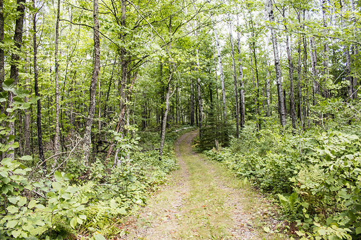
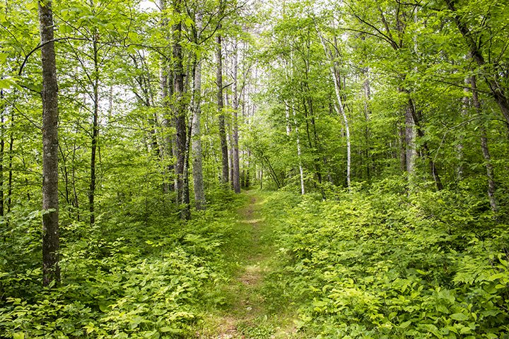
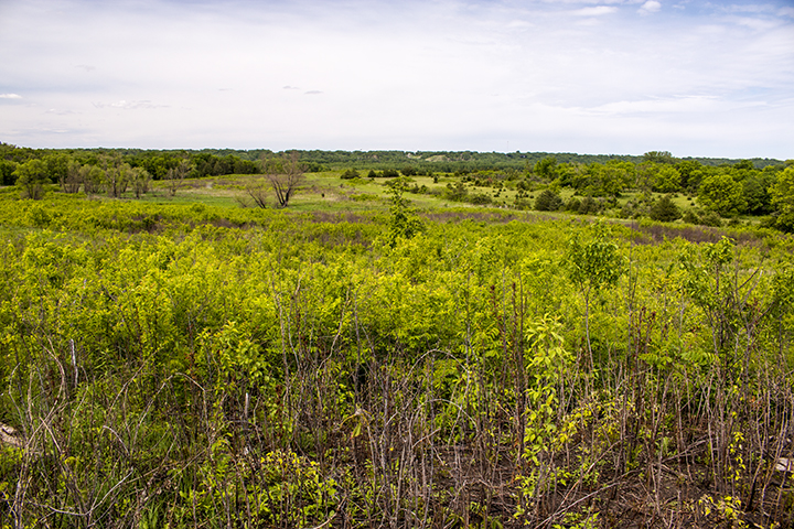
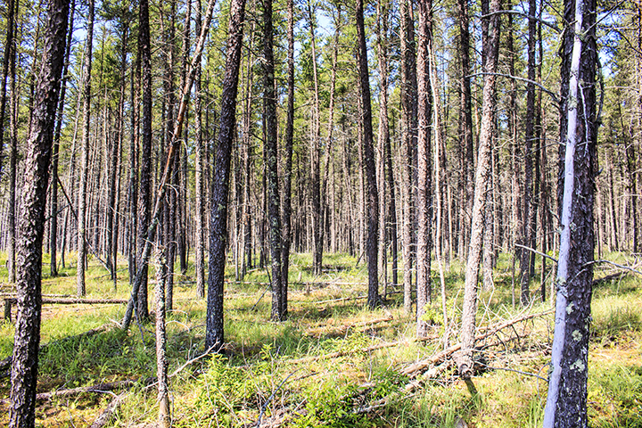
The Jack Pine – (Yarrow) Woodland native plant community (NPC) has been assigned the critically imperiled conservation status rank by the Minnesota DNR. A large block of this NPC was identified in southeast Hubbard County. Between 2006 and 2013 about half of the block was timber harvested. The DNR moved to protect what remained of the NPC on November 3, 2014, by designated the site as Badoura Jack Pine Woodland Scientific and Natural Area.

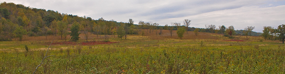
Today, the logged area is being allowed to regenerate to jack pine forest from the seed bank in the ground and from residual jack pines along the edges. A July, 2015 survey of 13 plots in the harvested area found 1,153 jack pine seedlings per acre.

Hill’s thistle, a special concern species in Minnesota, is found here, as well as bluebead lily, goldthread, ladies’ tresses, large cranberry, lowbush blueberry, oval-leaf milkweed, pipsissewa, and wintergreen.

http://minnesotaseasons.com/Destinations/Badoura_Jack_Pine_Woodland_SNA.html

Ritter Farm Park

Ritter Farm Park

At 340 acres, Ritter Farm Park is by far the largest in the City of Lakeville park system. Its 8.6 miles of hiking/equestrian trails meander around prairie openings and through undeveloped woodlands; across low ridges and into shallow ravines; and through the parks only native plant community, Pin Oak – Bur Oak Woodland. In the winter, 5.7 miles of the trails are groomed for cross-country skiing but are used mostly for winter hiking. Winter hikers do not have to share the trails with horseback riders.

For a park of this size Ritter Farm Park is little visited, even by Lakeville residents. This may be in part due to its out-of-the-way location. It is probably also due to the little exposure it receives on the City of Lakeville’s Website. The Web page for the park consists of a Google map, a link for the trail map and facilities, and a list of rules for horseback rides. Low visitor numbers may be seen as an asset for amateur naturalists or nature lovers looking for a solitary, not social, experience.

http://minnesotaseasons.com/Destinations/Ritter_Farm_Park.html

Sunfish Lake Park: A City Park for Nature Lovers

Sunfish Lake Park

Photo by Kirk Nelson

When searching for a location for a nature hike, nature lovers and amateur naturalists may not consider city parks. They are too small, too crowded, over developed, and unless they are nearby, too little known. Sunfish Lake Park should be on the radar for those looking for a nature site in the Twin Cities seven-county metro area.

At 284 acres, Sunfish Lake Park is a small park but the largest park in the City of Lake Elmo park system. It is conveniently located just north of Lake Elmo Park Reserve and unlike that park it does not charge a fee. The City of Lake Elmo calls it the “crown jewel of the Lake Elmo park system.” The Minnesota DNR designated it as a regionally significant ecological area (RSEA). The park includes two native plant communities, Oak – (Red Maple) Woodland and Red Oak – Sugar Maple – Basswood – (Bitternut Hickory) Forest. Thirteen bird species designated as of “greatest conservation need” have been seed here, including Acadian Flycatcher and Hooded Warbler, both species of special concern, and Bald Eagle, a tracked species. American ginseng, a plant species of special concern, is also found here.

Sunfish Lake Park

Nine miles of wide mowed trails wind through woodlands, around wetlands, and through a 17-acre prairie restoration. On winter weekends the trails are well used by cross-country skiers, dog walkers, and the occasional amateur naturalist.

http://minnesotaseasons.com/Destinations/Sunfish_Lake_Park.html

Ney Nature Center

Ney Nature Center

Photo by Michelle Isaacson

Ney Nature Center is a 446-acre park in Le Sueur County east of Henderson. It is adjacent on the north to Ney Wildlife Management Area and on the south to Henderson Station County Park/River Access. It includes the Minnesota River bluff to the west, the steep ravine of an unnamed, intermittent stream to the south, and prairie to the north.

Ney Nature Center is a hybrid, both a Le Sueur County park, open daily to the public, and a nature center, providing educational events for groups of children. It is one of 70 Minnesota Christmas Bird Count locations. Seventy-two bird species have been sited on bird count days from 1997 to 2014.

http://minnesotaseasons.com/Destinations/Ney_Nature_Center.html

Scenic State Park

Scenic State Park

In 1921, in an effort to preserve the birch and pines around Coon and Sandwick Lakes from logging, 2,121 acres in Itasca County were acquired and Scenic State Park was created. Subsequent land acquisitions have almost doubled the size of this park.

Two areas of the park are included separately on the National Register of Historic Places (NRHP), the service yard and the CCC Rustic Style Historic District. The service yard includes four buildings on the western shore of Sandwick Lake. The historic district is 16 acres on the south shore of Coon Lake that includes five buildings and a set of stone steps. The buildings in these areas were designed by the National Park Service and constructed by the Civilian Conservation Corps (CCC). They were designed in Rustic Style Architecture and built with a labor-intensive process. They are considered irreplaceable. The work was performed during the Great Depression between 1933 and 1935. On June 6, 1992, the service yard was placed in the NRHP. On June 8, 1992, the historic district was placed in the NRHP.

http://minnesotaseasons.com/Destinations/Scenic_State_Park.html

Savanna Portage State Park

Savanna Portage State Park

In 1961 the state of Minnesota set aside 14,000 acres in Aitkin County to preserve Savanna Portage, a 6-mile long, centuries old, canoe portage. Savanna Portage State park became Minnesota’s third largest state park. On April 23, 1973, Savanna Portage was placed on the National Register of Historic Places. The park today is 16,259 acres and receives 57,952 annual visits.

The northeast half of the park is mostly peat bog and mostly inaccessible except by the Savanna Portage Trail. The central portion of the park contains many small lakes, rolling hills, and long ridges. This area contains low areas of swamps, fens, and wet meadows separated and criss-crossed by hardwood- and mixed-forested ridges. The ridges are end moraines left by a retreating lobe in the last glaciation. Most of the park’s 32 miles of hiking trails are in this area.

Visitors this week (7/12 to 7/18/2015) will see purple pitcherplant, northern blue flag, and swamp candles blooming next to the bog boardwalk trail; American white waterlily and variegated yellow pond lily blooming on the surface of shallow lakes; elliptic shinleaf, white avens, yellow avens, limber honeysuckle, early figwort, American vetch, and veiny pea blooming in the forest; and black-eyed Susan blooming in forest openings. They will also see scores of northern crescents, many white admirals, and a few Canadian tiger swallowtail, Compton tortoiseshell, summer azure, and other butterflies.

http://minnesotaseasons.com/Destinations/Savanna_Portage_State_Park.html

Anna Gronseth Prairie

Anna Gronseth Prairie

This Wilkin County site became a preserve in 1973 when The Nature Conservancy (TNC) purchased 160 acres from Anna Gronseth. The intent of the purchase was to protect a booming ground of the greater prairie chicken, a species of special concern in Minnesota. TNC expanded the preserve at least seven times with additional land purchases over the next 26 years. Anna Gronseth Prairie is now 1,299 acres of mostly wet prairie with a few pockets of calcareous fen.

Visitors this week (6/28 to 7/4/2015) will find Canada anemone, mountain death camas, and prairie turnip at their peak, and golden ragwort, pale agoseris, and silverweed also blooming. If you are planning a visit, waterproof footwear is recommended.

http://minnesotaseasons.com/Destinations/Anna_Gronseth_Prairie.html


Blackhoof River WMA

Blackhoof River WMA

Blackhoof River WMA was created around 1991 to protect an important whitetail deer wintering site and portions of the Blackhoof River and Nemadji River corridors. It contains the confluence of the two rivers, about three miles of each river’s corridor, and the broad upland between.

The flat to gently rolling uplands are dissected by the deep valleys of these rivers, and by several ravines created by Deer Creek and other unnamed connecting streams. Areas of old growth forest remain in the river bottoms. There are 18.6 miles of wide hunter walking trails, mostly on the uplands, that are mowed every year.

Visitors this week (6/14 to 6/20/2015) will find bunchberry at its peak, and Canada anemone and downy arrowwood in bloom.

http://minnesotaseasons.com/Destinations/Blackhoof_River_WMA.html

St. Croix State Park

St. Croix State Park

In 1943 the 18,000-acre St. Croix Recreational Demonstration Area became Minnesota’s twenty-fourth state park. Additional land acquisitions have since made St. Croix State Park Minnesota’s largest state park, with over 34,000 acres. There are 127 miles of hiking trails, though most of those are shared with horseback riders. Most of the park is oak woodland, but closer inspection shows it to be a mosaic of 27 different native plant communities, including a rare jack pine barrens. Fourteen plant species with protected status in Minnesota are found here, including butternut, American ginseng, and Hill’s thistle.

Visitors to the park this week (June 14 to 20) will see Canada mayflower and Allegheny blackberry at their peak, as well as many white admiral and silvery checkerspot butterflies.

http://minnesotaseasons.com/Destinations/St_Croix_State_Park.html

Cedar Mountain SNA

Cedar Mountain SNA

During the last ice age eleven thousand years ago the Laurentide Ice Sheet covered all of what is now Minnesota except for the driftless area in the southeast and the inner coteau in the southwest. As the glacier retreated, meltwater flowing off of the Des Moines Lobe formed Glacial Lake Agassiz. The lake drained to the southeast through Glacial River Warren. Where it flowed through this part of Redwood County the river was over 1½ miles wide and covered almost all of this SNA. Only three tiny islands remained above water. On March 15, 2005, 317 acres of prairie, oak woodland, and floodplain forest in Redwood County was designated Cedar Mountain Scientific and Natural Area.

The northernmost part of the SNA is in the Mississippi River floodplain. It contains a silver maple floodplain forest and two shallow lakes. South of the lakes, at the western edge of the SNA, trees and shrubs have been removed to establish a rock outcrop prairie. South of the floodplain forest is a mature basswood-bur oak forest and a sliver of dry, rock outcrop prairie. The three islands in the River Warren are now knobs of bedrock outcrop in this section. The knobs contain unique rock types and rare plant species. The lower, middle section of the SNA is mostly mesic prairie and a very small rock outcrop prairie. The south section is more basswood bur-oak forest. Wabash Creek separates this section from 320th Street on the south border of the SNA.

Visitors to Cedar Mountain SNA this week (early June) will see in bloom abundant golden alexanders and, less conspicuous but almost equally abundant, long-leaved bluet.

http://minnesotaseasons.com/Destinations/Cedar_Mountain_SNA.html