Category Archives: Nature Destinations

Hastings Sand Coulee SNA

Hastings Sand Coulee SNA

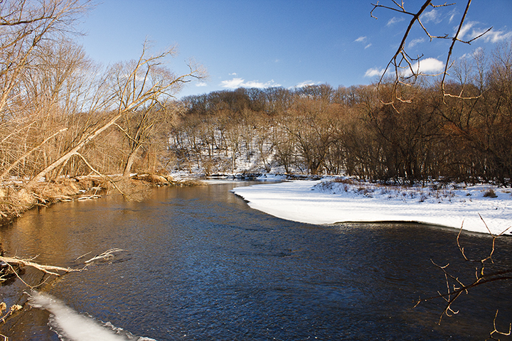
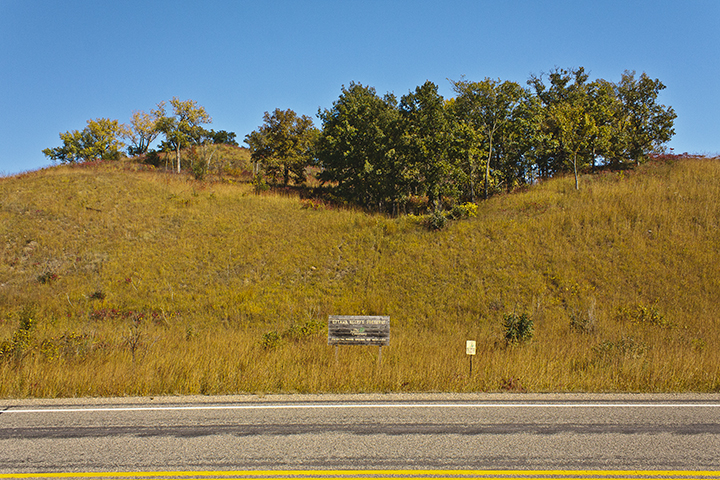
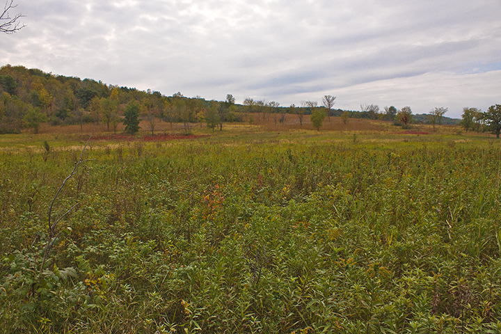
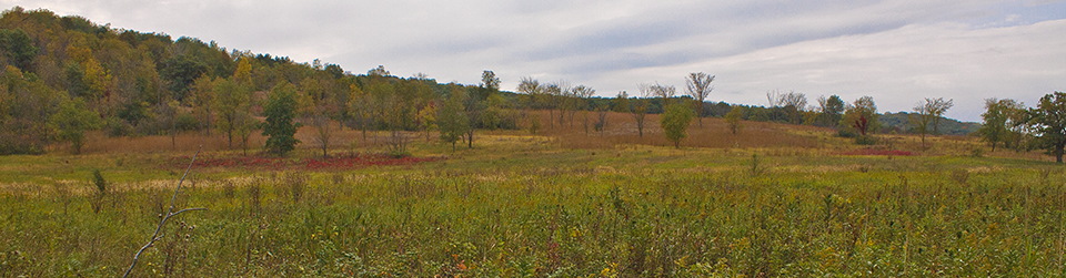
Hastings Sand Coulee Scientific and Natural Area (SNA) was first designated in 2007 and greatly expanded in 2011. The Minnesota Biological Survey identified this site as “one of the most biologically important sites in Dakota County.” An unnamed intermittent stream, a tributary of the Vermillion River, runs through all three of the disconnected units of this SNA. The South Unit is a 79-acre dry prairie with scattered eastern redcedar. The North Unit is 178 acres and includes a more diverse mix of dry prairie, oak woodland, and former cropland being restored to prairie. The tiny, 6¾-acre Center Unit is an abandoned gravel pit. Seven state listed species have been seen on at least one of the units, including Lark Sparrow, regal fritillary, and kittentails. Ottoe Skipper, a threatened species, has also been reported here but has not been added to the county distribution map for the state.

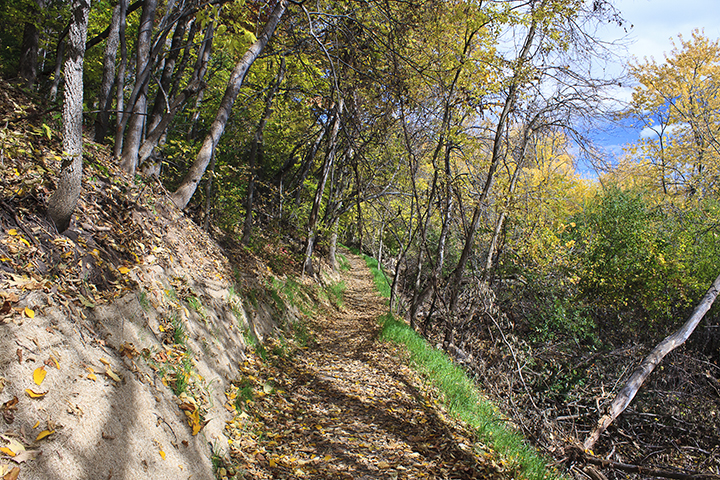
The Friends of the Mississippi River has done considerable work restoring the site. This is especially apparent in the North Unit. Following decades of fire suppression, what had once been a hill prairie has become bur oak woodland with a dense shrub understory. Most of the shrub layer in this section was removed in December, 2013. A large area of former cropland has been reseeded with prairie grasses and forbs. In the South Unit much of the common buckthorn has been removed from the area along MN Highway 361.

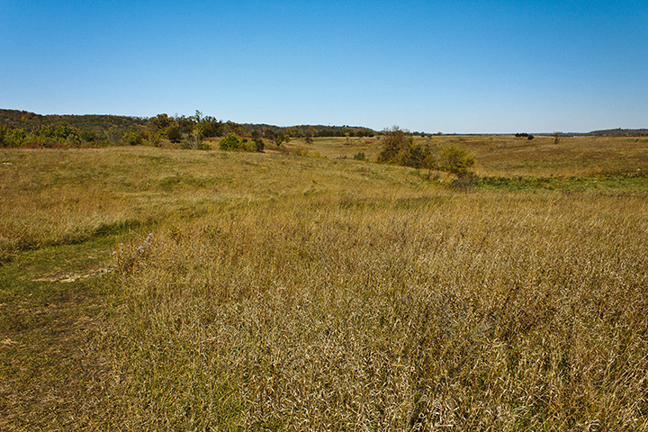
Visitors this week (late May) to the South Unit will find more fringed puccoon in bloom than they may have seen anywhere else. Hairy puccoon and hoary puccoon are also blooming here. Other flowers blooming now include birdfoot violet, prairie violet, prairie blue-eyed grass, ground plum, cypress spurge, balsam groundsel, narrow-leaved hawkweed, and narrow-leaved hawk’s-beard. If you walk slowly and look close you will also find in bloom corn speedwell, hairy purslane speedwell, and long-leaved bluet. Resident birds are curious about the occasional visitor. If you bring your binoculars you will probably spot a western meadowlark and a lark sparrow. You will certainly hear field, clay-colored, and grasshopper sparrows. In the North Unit kitten-tails, violet wood sorrel, winter cress, downy phlox, and smooth yellow violet are all in bloom this week.

http://minnesotaseasons.com/Destinations/Hastings_Sand_Coulee_SNA.html

Cannon River Wilderness Area

Cannon River Wilderness Area

Cannon River Wilderness Area is an 850 acre park in Rice County. It stretches 4.4 miles along both sides of the Cannon River. Forested hills and ravines, riverbottom forest, steep bluffs, and sheer cliffs are found within its boundaries. There is a picnic area with toilet facilities, five miles of trails, four primitive campsites, and a wooden pedestrian bridge over the Cannon River. Until recently, a 20-acre section of this park was owned by The Nature Conservancy and managed as Cannon Wilderness Woods Preserve.

http://minnesotaseasons.com/Destinations/Cannon_River_Wilderness_Area.html

Whitetail Woods Regional Park

Whitetail Woods Regional Park

Whitetail Woods Regional Park became Dakota County’s newest park when it opened on September 27, 2014. It is bordered on the east by the Vermillion Highlands Research Recreation and Wildlife Management Area, managed by the University of Minnesota and the Minnesota DNR. It is bordered on the south by the Vermillion River Wildlife Management Area. There are 10.25 miles of summer hiking trails including a 0.17 mile boardwalk across a wetland. In the winter there are 5.38 miles of snowshoeing/hiking trails. There is no fee to use or park at Dakota County parks.

http://minnesotaseasons.com/Destinations/Whitetail_Woods_Regional_Park.html

Minnesota Valley National Wildlife Refuge, Long Meadow Lake Unit

Minnesota Valley National Wildlife Refuge

The Long Meadow Lake Unit is one of eight units that make up the Minnesota Valley National Wildlife Refuge. It is the most visited of the eight units. It lies on the north bank of the Minnesota River just south of the Minneapolis-St. Paul International Airport. Fort Snelling State Park lies just across the river. In the spring of 2013 USFWS began an oak savanna restoration project on 5 acres near the Bloomington Visitor Center.

Minnesota Valley National Wildlife Refuge

There are more than 18 miles of hiking trails. Casual visitors can hike the 1 mile Hillside Trail or the 1.3 mile Bass Ponds Interpretive Trail. For a somewhat longer walk, there is the 7.3 mile north loop trail. Serious hikers can take the 16 mile south loop trail.

http://minnesotaseasons.com/Destinations/MN_Valley_NWR_Long_Meadow_Lake.html

Ottawa Bluffs

Ottawa Bluffs

The 62-acre Ottawa Bluffs Preserve consists of a patchwork of dry hill prairie and oak woodland on a steep bluff of the Minnesota River Valley. Visitors who undertake the steep and strenuous climb to the top of the bluff will be rewarded with an expansive view of the Minnesota River Valley and the town of St. Peter. An American Indian burial mound is at the top of the bluff. Western harvest mouse and a species of jumping spider, both species of special concern, and five state listed plant species have been found on the preserve.

The site has been owned since 1975 by The Nature Conservancy (TNC). The hill prairie, unsuitable for farming or pasture, remains mostly undisturbed by man. The previous owner began building a road from the bluff top to the base, but abandoned the effort less than half completed. The former roadbed is now grassy prairie and an eroded ravine. Decades of fire suppression have allowed woody species to encroach on and eliminate parts of the native prairie. Since 1989, volunteers for TNC have been working to remove juniper and other invasive woody species; check further erosion of the ravine; and restore a small part of oak woodland to its pre-settlement condition, oak savanna.

http://www.minnesotaseasons.com/Destinations/Ottawa_Bluffs.html

Kasota Prairie

Kasota Prairie

Kasota Prairie, a 90-acre remnant of native prairie, is a private preserve but is open to the public. It is owned by Unimin Minnesota Corporation and managed with the cooperation of Save the Kasota Prairie, a nonprofit organization. The west boundary of the site is the Minnesota River bluff. North of the site is a 60-acre Unimin-owned prairie that is off limits to visitors. There are two miles of natural surface hiking trails.

http://www.minnesotaseasons.com/Destinations/Kasota_Prairie.html

Pin Oak Prairie SNA

Pin Oak Prairie SNA

This 183-acre SNA lies within the Richard J. Dorer Memorial Hardwood State Forest. Despite its small size, it sits across two ECS subsections and three land type associations (LTAs). The north part of the site, adjacent to the Middle Branch Root River, is a 72-acre lowland with wet meadow on the Alluvial Plain LTA of The Blufflands subsection. This area also contains a sedge meadow native plant community, where there is always at least some standing water. South of the lowland a 108-acre slope climbs 250 feet in elevation on the Elba Slopes LTA of The Blufflands subsection. This slope is mostly wooded but includes a large area of dry prairie. In late summer much of this prairie is dominated by little bluestem. The wooded slope was once a brushland that, through decades of fire suppression, has developed into an oak woodland. The southeast corner of the site is 3 acres of oak woodland on the Stewartville Plain LTA of the Rochester Plateau subsection. Wild Turkeys nest in the wet meadow and Northern Bald Eagles have been seen circling above the SNA.

http://www.minnesotaseasons.com/Destinations/Pin_Oak_Prairie_SNA.html

Clifton E. French Regional Park

Clifton E. French Regional Park

This popular urban park on the north shore of Medicine Lake is surrounded on three sides by suburban housing. It has everything that its many visitors want, including a picnic area, fishing dock, swimming beach, boat launch, and a large playground. It also has 5.2 miles of natural surface hiking trails through deciduous woodlands. Visitors who come here for the trails are advised to come on a weekday when it is less crowded but still well used.

http://www.minnesotaseasons.com/Destinations/Clifton_E_French_Regional_Park.html

Glacial Lakes State Park

Glacial Lakes State Park

Several state parks in western Minnesota preserve parts of the state’s once vast tallgrass prairie. The best of these by far is Glacial Lakes State Park. It is located in the Leaf Hills, a 10 to 19 mile wide region of glacial hills stretching from Detroit Lakes to Willmar. Hiking trails on treeless, wide open prairie lead over rolling hills, eskers, kettles, and moraines. One section of the prairie loop trail follows ridge line with spectacular views of the prairie below. Another trail leads through bur oak forest. In all, there are 16 miles of natural surface hiking trails. If you visit, come early and plan to spend the whole day.

http://www.minnesotaseasons.com/Destinations/Glacial_Lakes_State_Park.html